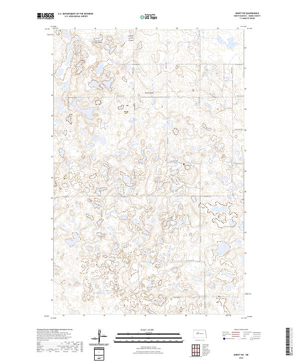
2024 Map of Minot SW
USGS Topo · Published 2024About this map
The rolling plains of Ward County are characterized by the distinct topography of Twin Buttes and a network of drainage features like Kemp Coulee and Second Larson Coulee. This high-plains landscape in western North Dakota is largely defined by its rural grid system, with routes such as 121st Ave SW and 72nd St SW providing access to isolated homesteads and agricultural tracts. A significant portion of the southeastern territory is dedicated to the Ward County Waterfowl Production Area, reflecting the region's importance for migratory birds and wetland preservation. For those researching local heritage, the Fron Lutheran Cem serves as a key landmark, situated in the eastern sections of the quadrangle near 163rd Ave SW. The survey clearly delineates the Township and Range boundaries, including t153n r84w and t153n r83w, which underpin the historic land distribution of the area.
Find a feature on this map
23 named features on this map. Tap any name to fly to it.
Don’t see what you’re looking for? This feature index may not catch every label — zoom into the map to look around manually.
Map Details
Editions of this 2024 Minot SW Map
This is the sole edition of this map. No revisions or reprints were ever made.
Other maps of this area

1928 · Minot
USGS Topo · 1:62,500

1948 · Minot NW
USGS Topo · 1:24,000

1949 · Minot NW
USGS Topo · 1:24,000

1949 · Minot
USGS Topo · 1:24,000

1954 · Minot
USGS Topo · 1:250,000

1954 · McClusky
USGS Topo · 1:250,000

1958 · McClusky
USGS Topo · 1:250,000

1958 · Minot
USGS Topo · 1:250,000
1966 · Minot
USGS Topo · 1:24,000

1980 · Minot
USGS Topo · 1:100,000