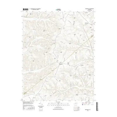
2016 Map of Mintonville
USGS Topo · Published 2016About this map
Mintonville and Bethelridge anchor this landscape along the Casey and Pulaski county line, where the terrain is defined by a dense network of ridges and knobs. The hydrological system is complex, featuring the S Fork Green River and numerous winding tributaries like Wolf Cr, Rock Lick Cr, and Pointer Cr. For local historians and genealogists, the map is remarkably dense with burial sites, including the Mintonville Cem, Grave Hill Cem, and Spaw Cem. Prominent high points such as Green River Knob and Henson Knob offer a clear sense of the area's relief. The distribution of small settlements like Argyle, Mangum, and Ware suggests a rural community structured around the many named ridges, such as Oak Hill Ridge and Vaught Ridge, which have historically dictated the placement of roads and homesteads.
Find a feature on this map
99 named features on this map. Tap any name to fly to it.
Don’t see what you’re looking for? This feature index may not catch every label — zoom into the map to look around manually.
Map Details
Editions of this 2016 Mintonville Map
This is the sole edition of this map. No revisions or reprints were ever made.
Other maps of this area

1935 · Somerset
USGS Topo · 1:62,500

1952 · Eubank
USGS Topo · 1:24,000

1952 · Liberty
USGS Topo · 1:24,000

1952 · Yosemite
USGS Topo · 1:24,000

1953 · Phil
USGS Topo · 1:24,000

1953 · Mintonville
USGS Topo · 1:24,000

1954 · Delmer
USGS Topo · 1:24,000

1954 · Science Hill
USGS Topo · 1:24,000

1954 · Eli
USGS Topo · 1:24,000
1954 · Faubush
USGS Topo · 1:24,000