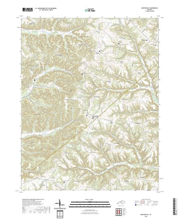
2022 Map of Mintonville
USGS Topo · Published 2022About this map
Mintonville and its surrounding ridge-and-hollow landscape are defined by the high ground of the Cains Store Cemetery Road and the dividing line between Casey and Pulaski counties. This modern topographic study reveals a community deeply rooted in its local geography, where settlements like Bethelridge and Pointer are connected by winding routes across features like Wilson Ridge and Hickory Nut Ridge. The headwaters of the South Fork Green River and various forks like Jonathan Fork carve through the terrain, creating the distinct knobs that characterize the region, including Green River Knob and Tarter Knob.
Find a feature on this map
101 named features on this map. Tap any name to fly to it.
Don’t see what you’re looking for? This feature index may not catch every label — zoom into the map to look around manually.
Map Details
Editions of this 2022 Mintonville Map
This is the sole edition of this map. No revisions or reprints were ever made.
Other maps of this area

1935 · Somerset
USGS Topo · 1:62,500

1952 · Eubank
USGS Topo · 1:24,000

1952 · Liberty
USGS Topo · 1:24,000

1952 · Yosemite
USGS Topo · 1:24,000

1953 · Phil
USGS Topo · 1:24,000

1953 · Mintonville
USGS Topo · 1:24,000

1954 · Delmer
USGS Topo · 1:24,000

1954 · Science Hill
USGS Topo · 1:24,000

1954 · Eli
USGS Topo · 1:24,000
1954 · Faubush
USGS Topo · 1:24,000