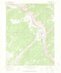
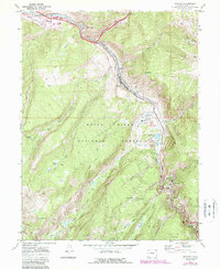
1970 Map of Minturn
USGS Topo · Published 1973About this map
The Eagle River carves a deep path through the White River National Forest in this 1970 snapshot of Eagle County. The settlement of Minturn serves as a hub where Gore Creek joins the main river, with the River View Cemetery and Battle Mountain High School marking the local community's footprint. Further south, the industrial character of the valley is defined by the Eagle Mine and the Newhouse Tunnel at Gilman, showing the heavy reliance on mineral extraction during this era.
Find a feature on this map
42 named features on this map. Tap any name to fly to it.
Don’t see what you’re looking for? This feature index may not catch every label — zoom into the map to look around manually.
Map Details
Editions of this 1970 Minturn Map
5 editions found
Other maps of this area

1889 · Leadville
USGS Topo · 1:125,000

1891 · Leadville
USGS Topo · 1:125,000

1909 · Mount Jackson
USGS Topo · 1:125,000

1911 · Mount Jackson
USGS Topo · 1:125,000

1934 · Minturn
USGS Topo · 1:62,500

1942 · Leadville
USGS Topo · 1:125,000

1949 · Holy Cross
USGS Topo · 1:62,500

1950 · Minturn
USGS Topo · 1:62,500

1951 · Holy Cross
USGS Topo · 1:62,500

1957 · Leadville
USGS Topo · 1:250,000