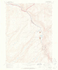
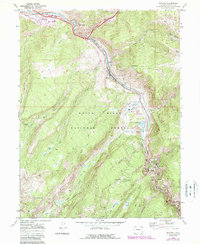
1970 Map of Minturn
USGS Topo · Published 1973About this map
Minturn and Gilman serve as the primary hubs in this mountainous industrial corridor, where the Denver and Rio Grande Western railroad follows the winding course of the Eagle River. The landscape is dominated by the extraction of mineral wealth, centered on the extensive Eagle Mine and its associated infrastructure like the Newhouse Tunnel and Air Shaft near the settlement of Belden. This 1970s record illustrates a valley balancing heavy industry with its role as a gateway to the surrounding wilderness, including the eastern reaches of the White River National Forest.
Find a feature on this map
43 named features on this map. Tap any name to fly to it.
Don’t see what you’re looking for? This feature index may not catch every label — zoom into the map to look around manually.
Map Details
Editions of this 1970 Minturn Map
5 editions found
Other maps of this area

1889 · Leadville
USGS Topo · 1:125,000

1891 · Leadville
USGS Topo · 1:125,000

1909 · Mount Jackson
USGS Topo · 1:125,000

1911 · Mount Jackson
USGS Topo · 1:125,000

1934 · Minturn
USGS Topo · 1:62,500

1942 · Leadville
USGS Topo · 1:125,000

1949 · Holy Cross
USGS Topo · 1:62,500

1950 · Minturn
USGS Topo · 1:62,500

1951 · Holy Cross
USGS Topo · 1:62,500

1957 · Leadville
USGS Topo · 1:250,000