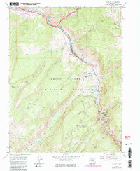
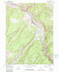
1970 Map of Minturn
USGS Topo · Published 1988About this map
Industrial activity and steep mountain geography define this study of the upper Eagle River canyon during the late twentieth century. The mining town of Gilman perches high above the river, supported by the extensive operations of the Eagle Mine, where specialized infrastructure like the Newhouse Tunnel and multiple air shafts are visible. The Denver and Rio Grande Western railroad corridor follows the narrow river valley, connecting the industrial nodes of Red Cliff and Minturn.
Find a feature on this map
54 named features on this map. Tap any name to fly to it.
Don’t see what you’re looking for? This feature index may not catch every label — zoom into the map to look around manually.
Map Details
Editions of this 1970 Minturn Map
5 editions found
Other maps of this area

1889 · Leadville
USGS Topo · 1:125,000

1891 · Leadville
USGS Topo · 1:125,000

1909 · Mount Jackson
USGS Topo · 1:125,000

1911 · Mount Jackson
USGS Topo · 1:125,000

1934 · Minturn
USGS Topo · 1:62,500

1942 · Leadville
USGS Topo · 1:125,000

1949 · Holy Cross
USGS Topo · 1:62,500

1950 · Minturn
USGS Topo · 1:62,500

1951 · Holy Cross
USGS Topo · 1:62,500

1957 · Leadville
USGS Topo · 1:250,000