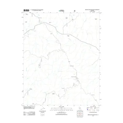
2012 Map of Miranda Pine Mountain
USGS Topo · Published 2012About this map
Cuyama Valley and the surrounding high-country peaks define this landscape on the edge of the Los Padres National Forest. The drainage of the Cuyama River provides a central axis for the map, where historical agricultural operations like Rock Front Ranch and Gifford Ranch are situated. The presence of Davis Cabin and several named springs, including Plowshare Spring and Miranda Pine Spring, suggests a long history of seasonal habitation and stock management in a region where water sources are critical landmarks.
Find a feature on this map
43 named features on this map. Tap any name to fly to it.
Don’t see what you’re looking for? This feature index may not catch every label — zoom into the map to look around manually.
Map Details
Editions of this 2012 Miranda Pine Mountain Map
This is the sole edition of this map. No revisions or reprints were ever made.
Other maps of this area

1902 · Santa Ynez
USGS Topo · 1:125,000

1905 · Santa Ynez
USGS Topo · 1:125,000

1905 · Lompoc
USGS Topo · 1:125,000

1912 · McKittrick
USGS Topo · 1:125,000

1937 · Branch Mtn
USGS Topo · 1:48,000

1941 · Caliente Mountain
USGS Topo · 1:62,500

1941 · McPherson Peak
USGS Topo · 1:62,500

1942 · Lompoc
USGS Topo · 1:125,000

1942 · Branch Mountain
USGS Topo · 1:62,500

1942 · Caliente Mtn
USGS Topo · 1:62,500