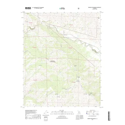
2018 Map of Miranda Pine Mountain
USGS Topo · Published 2018About this map
Los Padres National Forest anchors this high-elevation landscape in the Sierra Madre Mountains, where the border between San Luis Obispo and Santa Barbara counties meets. The Cuyama River winds across the northern half of the sheet, shadowed by steep canyon walls and a network of seasonal drainages like Aliso Cr and Sycamore Cr. This remote area is defined by its dramatic relief, featuring prominent summits such as Miranda Pine Mtn, Porter Peak, and Timber Peak. Geologists and backcountry researchers will find interest in the distinct Gypsum Canyon and the presence of scattered water sources including Miranda Pine Spring and Plowshare Spring. A sparse network of primitive roads, notably Old Sierra Madre Rd and Pine Canyon Rd, provides the only access through these high peaks and deep canyons like Flores Canyon.
Find a feature on this map
40 named features on this map. Tap any name to fly to it.
Don’t see what you’re looking for? This feature index may not catch every label — zoom into the map to look around manually.
Map Details
Editions of this 2018 Miranda Pine Mountain Map
This is the sole edition of this map. No revisions or reprints were ever made.
Other maps of this area

1902 · Santa Ynez
USGS Topo · 1:125,000

1905 · Santa Ynez
USGS Topo · 1:125,000

1905 · Lompoc
USGS Topo · 1:125,000

1912 · McKittrick
USGS Topo · 1:125,000

1937 · Branch Mtn
USGS Topo · 1:48,000

1941 · Caliente Mountain
USGS Topo · 1:62,500

1941 · McPherson Peak
USGS Topo · 1:62,500

1942 · Lompoc
USGS Topo · 1:125,000

1942 · Branch Mountain
USGS Topo · 1:62,500

1942 · Caliente Mtn
USGS Topo · 1:62,500