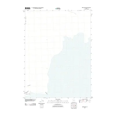
2011 Map of Miry Wash
USGS Topo · Published 2011About this map
Miry Wash winds through a landscape dominated by expansive mudflats and the isolated terrain of northwestern Utah. This corner of Box Elder County is defined by the stark boundary between the salt flats and the elevated formations of the Silver Island Mountains and the northern tip of Crater Island. The topographic detail reveals the intricate shoreline-like edges where the basin floor meets the rocky outcrops of the Little Pigeon Mountains. This map captures the remote character of the Great Salt Lake Desert, illustrating how drainage patterns like Miry Wash interact with the surrounding desert floor in an area with minimal human development or road infrastructure.
Find a feature on this map
4 named features on this map. Tap any name to fly to it.
Don’t see what you’re looking for? This feature index may not catch every label — zoom into the map to look around manually.
Map Details
Editions of this 2011 Miry Wash Map
This is the sole edition of this map. No revisions or reprints were ever made.
Other maps of this area

1954 · Brigham City
USGS Topo · 1:250,000

1958 · Brigham City
USGS Topo · 1:250,000

1962 · Brigham City
USGS Topo · 1:250,000

1967 · Pigeon Mountain
USGS Topo · 1:24,000

1967 · Lemay Island
USGS Topo · 1:24,000

1970 · Crater Island
USGS Topo · 1:24,000

1983 · Jackson
USGS Topo · 1:24,000
1983 · Lucin 4 SW
USGS Topo · 1:24,000

1983 · Bovine SE
USGS Topo · 1:24,000

1983 · Lucin 4 NE
USGS Topo · 1:24,000