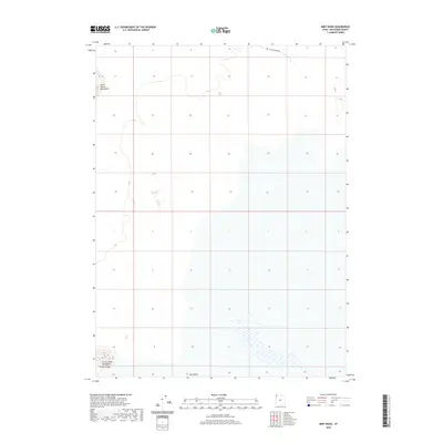
2020 Map of Miry Wash
USGS Topo · Published 2020About this map
Miry Wash cuts through a landscape defined by the stark isolation of the Great Salt Lake Desert, where sparse terrain features rise from the basin floor. The Little Pigeon Mountains dominate the northwestern corner of this quadrangle, while the southern edge is anchored by the Silver Island Mountains and the landform known as Crater Island. This 2020 record of Box Elder County captures a highly remote environment where human infrastructure is minimal, represented largely by the path of Little Pigeon Rd skirting the northern boundary. The mapping reveals the complex drainage patterns of the wash as it interacts with the surrounding topographic elevations, documenting a specialized desert geography that remains mostly undisturbed by modern development.
Find a feature on this map
5 named features on this map. Tap any name to fly to it.
Don’t see what you’re looking for? This feature index may not catch every label — zoom into the map to look around manually.
Map Details
Editions of this 2020 Miry Wash Map
This is the sole edition of this map. No revisions or reprints were ever made.
Other maps of this area

1954 · Brigham City
USGS Topo · 1:250,000

1958 · Brigham City
USGS Topo · 1:250,000

1962 · Brigham City
USGS Topo · 1:250,000

1967 · Pigeon Mountain
USGS Topo · 1:24,000

1967 · Lemay Island
USGS Topo · 1:24,000

1970 · Crater Island
USGS Topo · 1:24,000

1983 · Jackson
USGS Topo · 1:24,000
1983 · Lucin 4 SW
USGS Topo · 1:24,000

1983 · Bovine SE
USGS Topo · 1:24,000

1983 · Lucin 4 NE
USGS Topo · 1:24,000