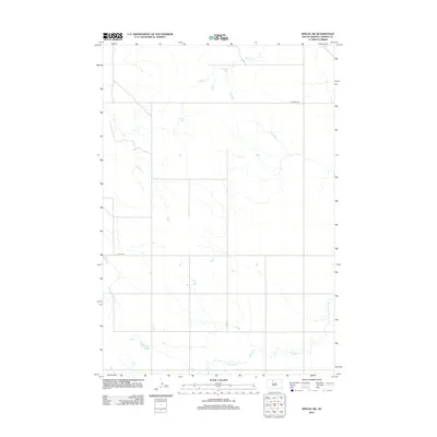
2012 Map of Miscol SW
USGS Topo · Published 2012About this map
Plum Cr and its network of dry washes define the topography of this portion of the Rock Creek District in Corson County. The landscape is characterized by its open, drainage-oriented layout, where the primary infrastructure consists of long-distance routes like Firesteel Rd and Co Rd-Cs21. These roads follow the section lines and natural contours of the northern plains, providing access to the expansive rangelands. In the southeastern corner, the meandering course of High Bank Cr cuts through the terrain, illustrating the water-scarce environment common to the Standing Rock Reservation area during this era. This 2012 survey serves as a clean record of the regional hydrology and the sparse grid of county roads that sustain local ranching and transport before further modern development.
Find a feature on this map
4 named features on this map. Tap any name to fly to it.
Don’t see what you’re looking for? This feature index may not catch every label — zoom into the map to look around manually.
Map Details
Editions of this 2012 Miscol SW Map
This is the sole edition of this map. No revisions or reprints were ever made.
Other maps of this area

1953 · McIntosh
USGS Topo · 1:250,000

1956 · Miscol SW
USGS Topo · 1:24,000

1956 · Black Horse NE
USGS Topo · 1:24,000

1956 · Black Horse SE
USGS Topo · 1:24,000

1956 · Miscol SE
USGS Topo · 1:24,000

1956 · Miscol
USGS Topo · 1:24,000

1956 · Miscol NE
USGS Topo · 1:24,000

1958 · McIntosh
USGS Topo · 1:250,000

1978 · Brewer Butte
USGS Topo · 1:24,000

1978 · Timber Lake
USGS Topo · 1:24,000