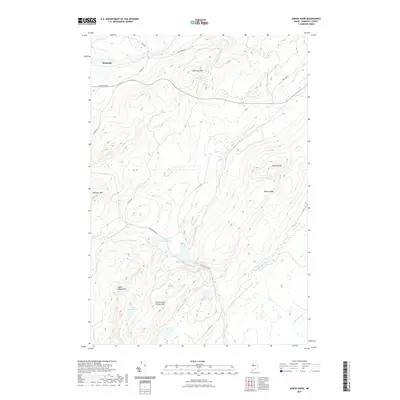
2021 Map of Misery Knob
USGS Topo · Published 2021About this map
Mackamp sits along the northern edge of this Somerset County landscape, situated near the headwaters that feed into the region's complex network of streams and ponds. The terrain is defined by a series of prominent rises including Misery Knob and the long spine of Misery Ridge, which separate the various drainage basins. The water system is particularly intricate, with Misery Stream flowing into Upper Misery Pond, while Churchill Stream and Coburn Brook drain the southern and eastern slopes.
Find a feature on this map
21 named features on this map. Tap any name to fly to it.
Don’t see what you’re looking for? This feature index may not catch every label — zoom into the map to look around manually.
Map Details
Editions of this 2021 Misery Knob Map
This is the sole edition of this map. No revisions or reprints were ever made.
Other maps of this area

1905 · The Forks
USGS Topo · 1:62,500

1907 · The Forks
USGS Topo · 1:62,500

1921 · Brassua Lake
USGS Topo · 1:62,500

1922 · Long Pond
USGS Topo · 1:62,500

1923 · Brassua Lake
USGS Topo · 1:62,500

1924 · Long Pond
USGS Topo · 1:62,500

1925 · Pierce Pond
USGS Topo · 1:48,000

1927 · Pierce Pond
USGS Topo · 1:62,500

1944 · Brassua Lake
USGS Topo · 1:62,500

1944 · Long Pond
USGS Topo · 1:62,500
Featured Places
- Misery Gore, ME
- Long Pond Township, ME
- Misery Township, ME
- Chase Stream Township, ME
- Sandwich Academy Grant Township, ME