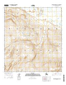
2015 Map of Misheguk Mountain A-2 SE
USGS Topo · Published 2015About this map
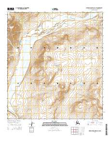
Noatak National Preserve encompasses the entirety of this Arctic landscape, defined by a massive drainage basin where the Noatak River meanders through the northern edge of the sheet. The terrain is characterized by a complex network of seasonal drainages and glacial features, notably where Little Cottonwood Cr flows southwest toward the interior of the preserve. This 2015 survey by the U.S. Geological Survey provides a precise topographic record of the wilderness just before more recent shifts in Arctic hydrology. Without any roads, settlements, or structures, the map focuses exclusively on the natural environment, marking the intersections of township lines like t31n r5w and t31n r4w as the only human-imposed markers on this expansive northern watershed.
Find a feature on this map
9 named features on this map. Tap any name to fly to it.
Don’t see what you’re looking for? This feature index may not catch every label — zoom into the map to look around manually.
Map Details
Editions of this 2015 Misheguk Mountain A-2 SE Map
This is the sole edition of this map. No revisions or reprints were ever made.
Other maps of this area

1951 · Baird Mountains
USGS Topo · 1:250,000

1951 · Misheguk Mountain
USGS Topo · 1:250,000

1956 · Misheguk Mountain
USGS Topo · 1:250,000

1956 · Baird Mountains
USGS Topo · 1:250,000

1965 · Baird Mountains
USGS Topo · 1:250,000
1990 · Misheguk Mountain A-2
USGS Topo · 1:63,360
1990 · Misheguk Mountain A-1
USGS Topo · 1:63,360
1990 · Baird Mountains D-2
USGS Topo · 1:63,360
2015 · Misheguk Mountain A-2 SW
USGS Topo · 1:25,000
2015 · Misheguk Mountain A-1 SW
USGS Topo · 1:25,000