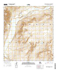
2015 Map of Misheguk Mountain A-2 SW
USGS Topo · Published 2015About this map
The Noatak River dominates this landscape within the Noatak National Preserve, a protected corridor in the northwest Arctic. The map illustrates a high-latitude drainage basin defined by braided water systems and glacial topography. Tributaries such as Uluksiak Cr and Arotak Cr cut through the terrain, indicating the seasonal flow patterns common to this subarctic region. The land is organized by the Public Land Survey System, showing several townships including t31n r6w and t32n r6w. This survey is notable for its depiction of a wilderness area largely devoid of permanent human infrastructure, focusing instead on the complex hydrography and elevation contours of the Noatak watershed before modern climate shifts further altered these northern watercourses.
Find a feature on this map
11 named features on this map. Tap any name to fly to it.
Don’t see what you’re looking for? This feature index may not catch every label — zoom into the map to look around manually.
Map Details
Editions of this 2015 Misheguk Mountain A-2 SW Map
This is the sole edition of this map. No revisions or reprints were ever made.
Other maps of this area

1951 · Baird Mountains
USGS Topo · 1:250,000

1951 · Misheguk Mountain
USGS Topo · 1:250,000

1955 · Baird Mountains D-3
USGS Topo · 1:63,360

1955 · Misheguk Mountain A-3
USGS Topo · 1:63,360

1956 · Misheguk Mountain
USGS Topo · 1:250,000

1956 · Baird Mountains
USGS Topo · 1:250,000

1965 · Baird Mountains
USGS Topo · 1:250,000
1990 · Misheguk Mountain A-2
USGS Topo · 1:63,360
1990 · Baird Mountains D-2
USGS Topo · 1:63,360
2015 · Misheguk Mountain A-2 SE
USGS Topo · 1:25,000