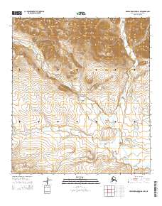
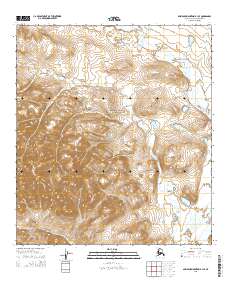
2015 Map of Misheguk Mountain B-1 NW
USGS Topo · Published 2015About this map
Noatak National Preserve defines the lower half of this landscape, where the Anisak River meanders through the high Arctic terrain of the North Slope. The topographical data reveals a transition from the elevated peaks in the northern sections, marked by township boundaries t11s r33w and t11s r32w, down toward the river valley in the south. The drainage patterns of Picnic Cr and the main river stem illustrate the hydraulic network of this remote wilderness as it was documented in 2015. This specific quadrant of the Misheguk Mountain area is largely defined by its natural hydrology and lack of human-made infrastructure, reflecting a strictly preserved ecological corridor within the Brooks Range foothills.
Find a feature on this map
7 named features on this map. Tap any name to fly to it.
Don’t see what you’re looking for? This feature index may not catch every label — zoom into the map to look around manually.
Map Details
Editions of this 2015 Misheguk Mountain B-1 NW Map
This is the sole edition of this map. No revisions or reprints were ever made.
Other maps of this area

1951 · Misheguk Mountain
USGS Topo · 1:250,000

1956 · Misheguk Mountain
USGS Topo · 1:250,000
1984 · Misheguk Mountain C-1
USGS Topo · 1:63,360
1984 · Misheguk Mountain C-2
USGS Topo · 1:63,360
1990 · Misheguk Mountain B-2
USGS Topo · 1:63,360
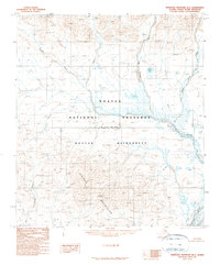
1990 · Misheguk Mountain B-1
USGS Topo · 1:63,360
2015 · Misheguk Mountain C-1 SW
USGS Topo · 1:25,000
2015 · Misheguk Mountain B-1 NE
USGS Topo · 1:25,000
2015 · Misheguk Mountain B-1 SW
USGS Topo · 1:25,000
2015 · Misheguk Mountain B-1 SE
USGS Topo · 1:25,000