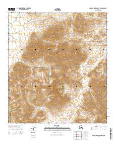
2015 Map of Misheguk Mountain B-5 SW
USGS Topo · Published 2015About this map
Noatak National Preserve encompasses the majority of this topographic study, where the high-latitude wilderness of the North Slope Borough meets the Northwest Arctic Borough. The landscape is defined by its drainage systems, most notably the south-flowing Augun River and the meandering headwaters of Kuruk Cr and Atmerich Cr. This survey illustrates the remote Arctic interior at the start of the 21st century, recorded via precision elevation data and the Public Land Survey System. The intersection of major townships including t34n r14w and t33n r13w provides a structural grid over the complex relief of the De Long Mountains foothills.
Find a feature on this map
11 named features on this map. Tap any name to fly to it.
Don’t see what you’re looking for? This feature index may not catch every label — zoom into the map to look around manually.
Map Details
Editions of this 2015 Misheguk Mountain B-5 SW Map
This is the sole edition of this map. No revisions or reprints were ever made.
Other maps of this area

1951 · De Long Mountains
USGS Topo · 1:250,000

1951 · Misheguk Mountain
USGS Topo · 1:250,000

1955 · De Long Mountains
USGS Topo · 1:250,000

1955 · Misheguk Mountain A-5
USGS Topo · 1:63,360

1955 · De Long Mountains A-1
USGS Topo · 1:63,360
1955 · De Long Mountains B-1
USGS Topo · 1:63,360

1956 · Misheguk Mountain
USGS Topo · 1:250,000

1965 · De Long Mountains
USGS Topo · 1:250,000
1990 · Misheguk Mountain B-5
USGS Topo · 1:63,360
2014 · Misheguk Mountain B-5 NE
USGS Topo · 1:25,000