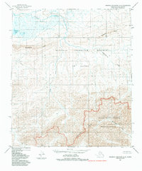
1984 Map of Misheguk Mountain C-5
USGS Topo · Published 1984About this map
The National Petroleum Reserve in Alaska meets the Noatak National Preserve in this mid-1980s look at the remote Brooks Range. This landscape is defined by the sharp transition between the arctic coastal plain drainage and the high alpine ridges of the north. To the north, Kokolik Lake and the meandering Iligluruk Creek dominate a terrain of tundra and wetlands. Moving south, the topography rises sharply into the high country of Sulungatak Ridge and Ilingnorak Ridge. The map documents federal boundaries established by the Alaska National Interest Lands Conservation Act of 1980, including the Noatak Wilderness. Named watercourses like Spike Creek and Nunaviksak Creek cut through the formidable Inaccessible Ridge, illustrating the drainage patterns that have shaped this roadless interior for millennia.
Find a feature on this map
16 named features on this map. Tap any name to fly to it.
Don’t see what you’re looking for? This feature index may not catch every label — zoom into the map to look around manually.
Map Details
Editions of this 1984 Misheguk Mountain C-5 Map
This is the sole edition of this map. No revisions or reprints were ever made.
Other maps of this area

1951 · De Long Mountains
USGS Topo · 1:250,000

1951 · Misheguk Mountain
USGS Topo · 1:250,000

1955 · De Long Mountains
USGS Topo · 1:250,000
1955 · De Long Mountains D-1
USGS Topo · 1:63,360
1955 · De Long Mountains C-1
USGS Topo · 1:63,360
1955 · De Long Mountains B-1
USGS Topo · 1:63,360

1956 · Misheguk Mountain
USGS Topo · 1:250,000

1965 · De Long Mountains
USGS Topo · 1:250,000
1984 · Misheguk Mountain D-5
USGS Topo · 1:63,360
1984 · Misheguk Mountain C-4
USGS Topo · 1:63,360