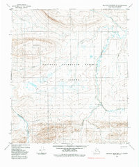
1984 Map of Misheguk Mountain D-3
USGS Topo · Published 1984About this map
National Petroleum Reserve in Alaska dominates this landscape, showing a remote arctic territory defined by its hydrologic network and industrial exploration routes in the mid-1970s. The Colville River carves through the eastern portion of the quadrangle, joined by tributaries such as Storm Creek and Thunder Creek. These waterways, alongside the prominent Meat Mountain, create a stark topography that necessitated specialized overland travel.
Find a feature on this map
10 named features on this map. Tap any name to fly to it.
Don’t see what you’re looking for? This feature index may not catch every label — zoom into the map to look around manually.
Map Details
Editions of this 1984 Misheguk Mountain D-3 Map
This is the sole edition of this map. No revisions or reprints were ever made.
Other maps of this area

1951 · Utukok River
USGS Topo · 1:250,000

1951 · Misheguk Mountain
USGS Topo · 1:250,000
1955 · Utukok River A-4
USGS Topo · 1:63,360
1955 · Utukok River A-3
USGS Topo · 1:63,360

1956 · Misheguk Mountain
USGS Topo · 1:250,000

1956 · Utukok River
USGS Topo · 1:250,000

1965 · Utukok River
USGS Topo · 1:250,000
1984 · Misheguk Mountain C-2
USGS Topo · 1:63,360
1984 · Misheguk Mountain C-3
USGS Topo · 1:63,360
1984 · Misheguk Mountain D-2
USGS Topo · 1:63,360