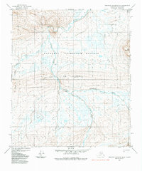
1984 Map of Misheguk Mountain D-4
USGS Topo · Published 1984About this map
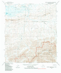
The Utukok River meanders through this remote Arctic landscape within the National Petroleum Reserve in Alaska during the mid-1970s. The terrain is defined by a dense network of hydrologic features, including Driftwood Creek, Adventure Creek, and Nimwutik Creek. To the east, the prominent Meat Mountain rises above the surrounding tundra and wetlands. This area represents a wilderness focused on resource evaluation rather than settlement, evidenced by the presence of a Landing Area and various Tractor Trails cutting across the permafrost. The survey highlights the characteristic drainage patterns of the North Slope, where smaller tributaries like Pattern Creek, Tupikchak Creek, and Plunge Creek feed into the larger river system, illustrating the complex seasonal water flow across this protected reserve.
Find a feature on this map
12 named features on this map. Tap any name to fly to it.
Don’t see what you’re looking for? This feature index may not catch every label — zoom into the map to look around manually.
Map Details
Editions of this 1984 Misheguk Mountain D-4 Map
This is the sole edition of this map. No revisions or reprints were ever made.
Other maps of this area

1951 · Utukok River
USGS Topo · 1:250,000

1951 · Misheguk Mountain
USGS Topo · 1:250,000
1955 · Utukok River A-5
USGS Topo · 1:63,360
1955 · Utukok River A-4
USGS Topo · 1:63,360
1955 · Utukok River A-3
USGS Topo · 1:63,360

1956 · Misheguk Mountain
USGS Topo · 1:250,000

1956 · Utukok River
USGS Topo · 1:250,000

1965 · Utukok River
USGS Topo · 1:250,000
1984 · Misheguk Mountain C-5
USGS Topo · 1:63,360
1984 · Misheguk Mountain C-3
USGS Topo · 1:63,360