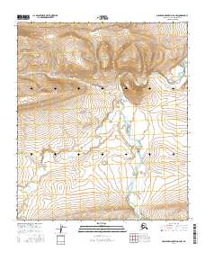
2016 Map of Misheguk Mountain D-4 NW
USGS Topo · Published 2016About this map
The Utukok River dominates this Arctic drainage basin, winding northward through the remote Brooks Range foothills of the North Slope. This 2016 survey illustrates a landscape defined by its intricate fluvial systems, where the braided main channel of the river receives significant tributaries including Tupikchak Cr and Nimiutik Cr. The terrain is characterized by high-latitude hydrology, with Plunge Cr and Pattern Cr dissecting the uplands. Grounded in data from the Alaska Department of Transportation and the National Wetlands Inventory, the map provides an essential record of the natural contours and watercourses of the Misheguk Mountain D-4 NW quadrangle, far above the Arctic Circle in a region where seasonal river movements dictate the character of the land.
Find a feature on this map
9 named features on this map. Tap any name to fly to it.
Don’t see what you’re looking for? This feature index may not catch every label — zoom into the map to look around manually.
Map Details
Editions of this 2016 Misheguk Mountain D-4 NW Map
This is the sole edition of this map. No revisions or reprints were ever made.
Other maps of this area

1951 · Utukok River
USGS Topo · 1:250,000

1951 · Misheguk Mountain
USGS Topo · 1:250,000
1955 · Utukok River A-5
USGS Topo · 1:63,360
1955 · Utukok River A-4
USGS Topo · 1:63,360

1956 · Misheguk Mountain
USGS Topo · 1:250,000

1956 · Utukok River
USGS Topo · 1:250,000

1965 · Utukok River
USGS Topo · 1:250,000
1984 · Misheguk Mountain D-5
USGS Topo · 1:63,360
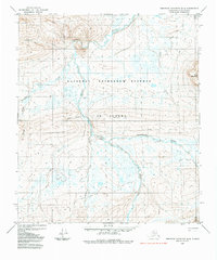
1984 · Misheguk Mountain D-4
USGS Topo · 1:63,360
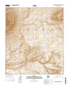
2015 · Misheguk Mountain D-5 SE
USGS Topo · 1:25,000