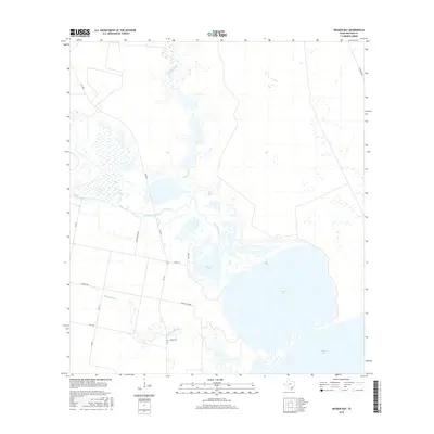
2016 Map of Mission Bay
USGS Topo · Published 2016About this map
Mission River winds southward through Refugio County, emptying into the complex estuarine waters of Mission Lake and Mission Bay. This coastal landscape is defined by its low-lying wetlands and tidal influences, where Melon Creek and Mullens Bayou contribute to the hydrologic network feeding into Copano Bay. The area remains largely rural and dominated by natural water features, with local access provided by a network of secondary roads including FM 2678 and FM 136.
Find a feature on this map
19 named features on this map. Tap any name to fly to it.
Don’t see what you’re looking for? This feature index may not catch every label — zoom into the map to look around manually.
Map Details
Editions of this 2016 Mission Bay Map
This is the sole edition of this map. No revisions or reprints were ever made.
Other maps of this area

1953 · Beeville
USGS Topo · 1:250,000

1954 · Rockport
USGS Topo · 1:62,500

1954 · Woodsboro
USGS Topo · 1:62,500

1954 · Vidaurri
USGS Topo · 1:62,500

1954 · Refugio
USGS Topo · 1:62,500

1956 · Beeville
USGS Topo · 1:250,000

1960 · Beeville
USGS Topo · 1:250,000

1978 · Woodsboro
USGS Topo · 1:24,000
1978 · Twin Mott Lake
USGS Topo · 1:24,000
1979 · Mission Bay
USGS Topo · 1:24,000