
1978 Map of Woodsboro
USGS Topo · Published 1978About this map
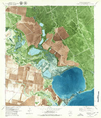
The town of Woodsboro serves as the focal point of this coastal prairie landscape, where the agricultural grid is heavily overlaid by the infrastructure of the Texas energy sector. The 1970s marked a period of mature production for the Roche Oil and Gas Field and the La Rosa Oil Field, which are evidenced by numerous wells and pipelines cutting across the terrain. This industrial presence contrasts with the traditional community landmarks like St Bernard Cem and the Missouri Pacific railroad corridor. The Southern boundary is defined by the winding course of the Aransas River, featuring prominent bends like Huisache Bend and La Bolsa Bend. To the east, the Mission River and McGuill Lake highlight the riparian lowlands of Refugio County, while the small settlement of Bonnie View anchors the southeastern fields.
Find a feature on this map
29 named features on this map. Tap any name to fly to it.
Don’t see what you’re looking for? This feature index may not catch every label — zoom into the map to look around manually.
Map Details
Editions of this 1978 Woodsboro Map
This is the sole edition of this map. No revisions or reprints were ever made.
Other maps of this area

1953 · Beeville
USGS Topo · 1:250,000

1954 · Rockport
USGS Topo · 1:62,500

1954 · Woodsboro
USGS Topo · 1:62,500

1954 · Vidaurri
USGS Topo · 1:62,500

1954 · Refugio
USGS Topo · 1:62,500

1956 · Beeville
USGS Topo · 1:250,000

1960 · Beeville
USGS Topo · 1:250,000

1978 · Cranell
USGS Topo · 1:24,000

1978 · Refugio SW
USGS Topo · 1:24,000
1979 · Mission Bay
USGS Topo · 1:24,000