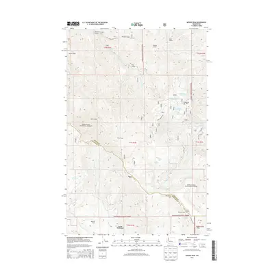
2014 Map of Mission Peak
USGS Topo · Published 2014About this map
The Mission Peak area in Wenatchee National Forest marks the high-elevation boundary where Chelan County meets Kittitas County. This 2014 survey details the complex drainages of Mission Creek and Squilchuck Creek, which carve deep canyons such as Peavine Canyon and Pendleton Canyon through the eastern Cascades. The map reveals the historical and recreational footprint of the region, from the high-altitude Naneum Lookout and Naneum Point to secluded alpine water bodies like Clara Lake and Marion Lake. Of particular interest to local historians is the southern portion of the map, which includes Dutch Settlement and the extensive Naneum Basin. A network of forest roads, including Liberty Beehive Road and Number Two Canyon Road, provides access to landmarks like Beehive Mountain and its associated Beehive Reservoirs, illustrating the management of water resources in this timbered landscape.
Find a feature on this map
42 named features on this map. Tap any name to fly to it.
Don’t see what you’re looking for? This feature index may not catch every label — zoom into the map to look around manually.
Map Details
Editions of this 2014 Mission Peak Map
This is the sole edition of this map. No revisions or reprints were ever made.
Other maps of this area

1897 · Mount Stuart
USGS Topo · 1:125,000

1902 · Mount Stuart
USGS Topo · 1:125,000

1913 · Wenatchee
USGS Topo · 1:62,500

1915 · Wenatchee
USGS Topo · 1:62,500

1920 · Colockum Pass
USGS Topo · 1:125,000

1922 · Colockum Pass
USGS Topo · 1:125,000

1957 · Wenatchee
USGS Topo · 1:250,000

1958 · Thorp
USGS Topo · 1:62,500

1961 · Liberty
USGS Topo · 1:62,500

1966 · Wenatchee
USGS Topo · 1:24,000