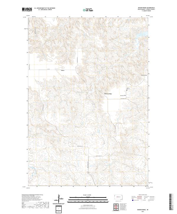
2021 Map of Mission Ridge
USGS Topo · Published 2021About this map
Mission Ridge and the nearby Orton settlement define this portion of Stanley County, where the high plains break toward the massive reservoir of the Missouri River Lake Oahe. The landscape is etched by a dense network of drainages including Brush Creek, Oak Creek, and Agency Creek, which feed into the primary river system. Local history is anchored at the Mission Ridge Cemetery, situated near the junction of Fort Bennett Road and Mission Ridge Road. The cartography reveals a transition from the structured township and range grid of t9n r27e and its neighbors to the irregular, winding paths of historic trails and current roads like Minneconjou Road, which follows the high ground between the deeply cut draws of Whiteman Draw and Shack Creek.
Find a feature on this map
21 named features on this map. Tap any name to fly to it.
Don’t see what you’re looking for? This feature index may not catch every label — zoom into the map to look around manually.
Map Details
Editions of this 2021 Mission Ridge Map
This is the sole edition of this map. No revisions or reprints were ever made.
Other maps of this area

1954 · Pierre
USGS Topo · 1:250,000

1956 · Rousseau Creek SW
USGS Topo · 1:24,000

1956 · Crockett Mountains
USGS Topo · 1:24,000

1958 · Pierre
USGS Topo · 1:250,000

1969 · Rousseau Creek
USGS Topo · 1:24,000

1969 · No Heart Creek SW
USGS Topo · 1:24,000

1973 · Iron Post Buttes SW
USGS Topo · 1:24,000

1973 · Iron Post Buttes
USGS Topo · 1:24,000

1982 · Mission Ridge
USGS Topo · 1:24,000

1983 · Standing Butte
USGS Topo · 1:24,000