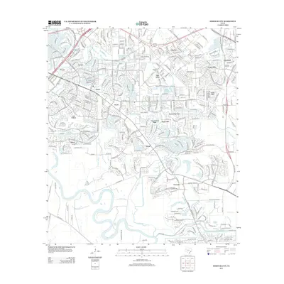
2013 Map of Missouri City
USGS Topo · Published 2013About this map
The Brazos River winds through the southwestern portion of this 2013 survey, defining a landscape shaped by oxbows and floodplains. To the east, suburban expansion is clearly visible in the transition from established communities like Dewalt and Trammels to the modern residential clusters of First Colony and Quail Valley East. The map provides a detailed view of local burial grounds, including Cementerio San Isidro and Dewalt Cem, which offer significant touchpoints for genealogical research in this part of Fort Bend and Harris Counties. Water features dominate the geography, from the meandering Steep Bank Creek and Oyster Cr to named bodies like Hermann Hospital Lake and Kitty Hollow Lake. The road network is framed by arterial routes such as S Sam Houston Pkwy W and McHard Rd, illustrating the rapid growth of Hunters Glen and Chasewood in the early 21st century.
Find a feature on this map
42 named features on this map. Tap any name to fly to it.
Don’t see what you’re looking for? This feature index may not catch every label — zoom into the map to look around manually.
Map Details
Editions of this 2013 Missouri City Map
This is the sole edition of this map. No revisions or reprints were ever made.
Other maps of this area

1915 · Bellaire
USGS Topo · 1:24,000

1915 · Alief
USGS Topo · 1:24,000

1915 · Clodine
USGS Topo · 1:24,000

1919 · Clodine
USGS Topo · 1:31,680

1920 · Almeda
USGS Topo · 1:31,680

1921 · Bellaire
USGS Topo · 1:31,680

1943 · Juliff
USGS Topo · 1:31,680

1950 · Houston
USGS Topo · 1:250,000

1953 · Lake George
USGS Topo · 1:24,000

1953 · Thompsons
USGS Topo · 1:24,000