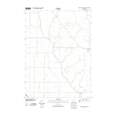
2010 Map of Missouri Valley NW
USGS Topo · Published 2010About this map
Magnolia and Calhoun serve as the primary focal points of this Harrison County landscape, where the agricultural grid is defined by a complex network of natural waterways and man-made drainage systems. The survey illustrates a terrain deeply modified for farming, featuring the East Soldier Ditch, Nelson Ditch, and Modale Ditch alongside natural courses like Steer Creek and Allen Creek. These drainage features indicate the persistent effort to manage the local watershed for cultivation in the Loess Hills region. Genealogists will find notable value in the inclusion of the Magnolia Cemetery and Calhoun Cemetery, while the small settlement of Echo remains marked in the northern portion of the map. The road network, including Florence Ave and Laredo Ave, follows the section lines, reinforcing the structured development of this rural Iowa territory.
Find a feature on this map
40 named features on this map. Tap any name to fly to it.
Don’t see what you’re looking for? This feature index may not catch every label — zoom into the map to look around manually.
Map Details
Editions of this 2010 Missouri Valley NW Map
This is the sole edition of this map. No revisions or reprints were ever made.
Other maps of this area

1954 · Omaha
USGS Topo · 1:250,000

1955 · Fremont
USGS Topo · 1:250,000

1957 · Fremont
USGS Topo · 1:250,000

1957 · Omaha
USGS Topo · 1:250,000

1958 · Omaha
USGS Topo · 1:250,000

1958 · Fremont
USGS Topo · 1:250,000

1970 · Little Sioux
USGS Topo · 1:24,000

1970 · Logan
USGS Topo · 1:24,000
1970 · Missouri Valley
USGS Topo · 1:24,000

1970 · Mondamin
USGS Topo · 1:24,000