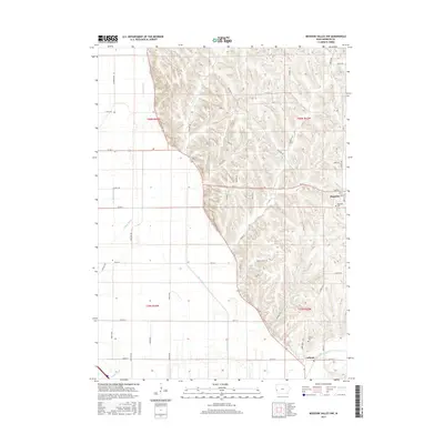
2015 Map of Missouri Valley NW
USGS Topo · Published 2015About this map
Magnolia and the nearby settlement of Calhoun sit at the intersection of Iowa's Loess Hills and its agricultural plains. The topography reveals a striking contrast between the heavily eroded bluffs to the east and the flat, engineered valley floor to the west. This lowland drainage is managed through a complex network of man-made waterways including E Soldier Ditch, Nelson Ditch, and Modale Ditch, which work alongside natural flows like Allen Creek and Willow Creek. For local historians and genealogists, the map identifies specific community landmarks such as Magnolia Cem and Calhoun Cem. The transition from winding ridge roads like Harvard Trl to the rigid section-line grid of the valley reflects the historic adaptation of Iowa's transport and farming infrastructure to its unique western landscape.
Find a feature on this map
59 named features on this map. Tap any name to fly to it.
Don’t see what you’re looking for? This feature index may not catch every label — zoom into the map to look around manually.
Map Details
Editions of this 2015 Missouri Valley NW Map
This is the sole edition of this map. No revisions or reprints were ever made.
Other maps of this area

1954 · Omaha
USGS Topo · 1:250,000

1955 · Fremont
USGS Topo · 1:250,000

1957 · Fremont
USGS Topo · 1:250,000

1957 · Omaha
USGS Topo · 1:250,000

1958 · Omaha
USGS Topo · 1:250,000

1958 · Fremont
USGS Topo · 1:250,000

1970 · Little Sioux
USGS Topo · 1:24,000

1970 · Logan
USGS Topo · 1:24,000
1970 · Missouri Valley
USGS Topo · 1:24,000

1970 · Mondamin
USGS Topo · 1:24,000