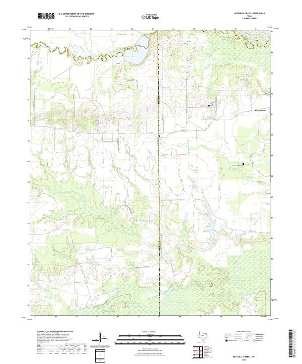
2022 Map of Mitchell Creek
USGS Topo · Published 2022About this map
Hagansport stands at the eastern edge of this landscape where Northeast Texas ranching and timberlands meet the intricate drainage systems of the upper Sulphur River basin. The terrain is defined by a dense network of watercourses, including Mitchell Cr and White Oak Cr, which carve through the countryside along the borders of Hopkins and Franklin counties. Local history is anchored by several rural landmarks, such as Fairview Cem and Pierce Chapel Cem, which offer significant points of interest for genealogists tracing family roots in this corner of the state. The northern boundary is marked by the South Sulphur River, while an array of county roads like Co RD 3548 and Co RD NW 1080 connect the dispersed farmsteads and creek bottoms that characterize this quiet agricultural region.
Find a feature on this map
41 named features on this map. Tap any name to fly to it.
Don’t see what you’re looking for? This feature index may not catch every label — zoom into the map to look around manually.
Map Details
Editions of this 2022 Mitchell Creek Map
This is the sole edition of this map. No revisions or reprints were ever made.
Other maps of this area

1953 · Texarkana
USGS Topo · 1:250,000

1956 · Texarkana
USGS Topo · 1:250,000

1962 · Sulphur Bluff
USGS Topo · 1:24,000

1963 · Mitchell Creek
USGS Topo · 1:24,000

1963 · Minter
USGS Topo · 1:24,000

1963 · Cunningham
USGS Topo · 1:24,000

1964 · Mount Vernon
USGS Topo · 1:24,000

1964 · Saltillo
USGS Topo · 1:24,000

1964 · Hagansport
USGS Topo · 1:24,000

1964 · Bogata
USGS Topo · 1:24,000