
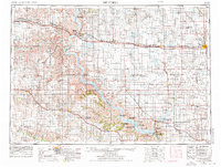
1955 Map of Mitchell
USGS Topo · Published 1973About this map
The Missouri River dominates this mid-century survey, shown here just as the Fort Randall Dam was fundamentally altering the South Dakota landscape. The creation of Lake Francis Case is visible as it backs up through the Rosebud Indian Reservation and Lower Brule Indian Reservation, submerging the old river valley. This era of massive federal engineering coincides with a well-established rail network, featuring the Chicago Milwaukee St Paul and Pacific line serving agricultural hubs like Mitchell and Stickney.
Find a feature on this map
156 named features on this map. Tap any name to fly to it.
Don’t see what you’re looking for? This feature index may not catch every label — zoom into the map to look around manually.
Map Details
Editions of this 1955 Mitchell Map
2 editions found
Other maps of this area

1898 · Olivet
USGS Topo · 1:125,000

1898 · Huron
USGS Topo · 1:125,000

1899 · Mitchell
USGS Topo · 1:125,000

1899 · Alexandria
USGS Topo · 1:125,000

1899 · De Smet
USGS Topo · 1:125,000

1935 · Chamberlain
USGS Topo · 1:62,500

1939 · Chamberlain
USGS Topo · 1:62,500

1940 · Iona
USGS Topo · 1:62,500

1941 · Pukwana
USGS Topo · 1:62,500

1941 · Kimball North
USGS Topo · 1:62,500