
1959 Map of Mitchell
USGS Topo · Published 1959About this map
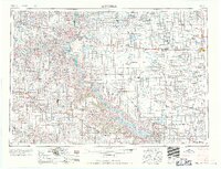
The Missouri River carves a deep valley through the heart of South Dakota, anchoring a landscape where river travel, rail lines, and indigenous reservations intersect. This late-1950s survey documents the region during a period of massive hydraulic engineering, noting the Fort Randall Dam as it began to reshape the river into Lake Francis Case. To the east, the agricultural hub of Mitchell is surrounded by a network of smaller rail towns and crossroads like Plankinton, Stickney, and Wagner.
Find a feature on this map
111 named features on this map. Tap any name to fly to it.
Don’t see what you’re looking for? This feature index may not catch every label — zoom into the map to look around manually.
Map Details
Editions of this 1959 Mitchell Map
2 editions found
Other maps of this area

1898 · Olivet
USGS Topo · 1:125,000

1898 · Huron
USGS Topo · 1:125,000

1899 · Mitchell
USGS Topo · 1:125,000

1899 · Alexandria
USGS Topo · 1:125,000

1899 · De Smet
USGS Topo · 1:125,000

1935 · Chamberlain
USGS Topo · 1:62,500

1939 · Chamberlain
USGS Topo · 1:62,500

1940 · Iona
USGS Topo · 1:62,500

1941 · Pukwana
USGS Topo · 1:62,500

1941 · Kimball North
USGS Topo · 1:62,500