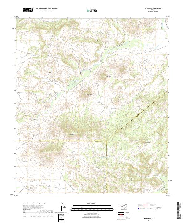
2022 Map of Mitre Peak
USGS Topo · Published 2022About this map
Mitre Peak and the surrounding volcanic landscape of the Trans-Pecos dominate this topographic survey at the intersection of Jeff Davis, Brewster, and Presidio counties. The map captures a high-desert environment defined by dramatic elevation changes, from the prominent heights of Antelope Peak and the Twin Mountains to the depths of Musquiz Canyon and Pinon Canyon. Water sources are critical landmarks in this arid region, as evidenced by Tippett Springs and Ramirez Tank.
Find a feature on this map
24 named features on this map. Tap any name to fly to it.
Don’t see what you’re looking for? This feature index may not catch every label — zoom into the map to look around manually.
Map Details
Editions of this 2022 Mitre Peak Map
This is the sole edition of this map. No revisions or reprints were ever made.
Other maps of this area

1894 · Fort Davis
USGS Topo · 1:125,000

1895 · Alpine
USGS Topo · 1:125,000

1897 · Fort Davis
USGS Topo · 1:125,000

1954 · Fort Stockton
USGS Topo · 1:250,000

1958 · Fort Stockton
USGS Topo · 1:250,000
1972 · Fort Davis SE
USGS Topo · 1:24,000

1972 · Alpine North
USGS Topo · 1:24,000
1972 · Fort Davis
USGS Topo · 1:24,000

1972 · Paisano
USGS Topo · 1:24,000

1972 · Mitre Peak
USGS Topo · 1:24,000