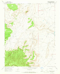
1966 Map of Mitten Rock
USGS Topo · Published 1969About this map
Mitten Rock stands as a prominent landmark within the Navajo Indian Reservation, anchoring a landscape defined by an intricate network of desert drainages and high terrain. This mid-1960s survey captures the geography of the high plateau country in San Juan County, dominated to the south by the rising slopes of Beautiful Mountain. Water management and resource extraction are evident across the arid floor, from the Big Gap Reservoir to several scattered Drill Hole and Flowing Well sites.
Find a feature on this map
19 named features on this map. Tap any name to fly to it.
Don’t see what you’re looking for? This feature index may not catch every label — zoom into the map to look around manually.
Map Details
Editions of this 1966 Mitten Rock Map
3 editions found
Other maps of this area

1889 · Chaco
USGS Topo · 1:250,000

1892 · Chaco
USGS Topo · 1:250,000

1892 · Canyon De Chelly
USGS Topo · 1:250,000

1934 · Ship Rock
USGS Topo · 1:62,500

1937 · Ship Rock
USGS Topo · 1:62,500

1953 · Sanostee
USGS Topo · 1:62,500

1953 · Redrock Valley NE
USGS Topo · 1:24,000

1953 · Redrock Valley SE
USGS Topo · 1:24,000

1953 · Redrock Valley
USGS Topo · 1:62,500

1954 · Shiprock
USGS Topo · 1:250,000