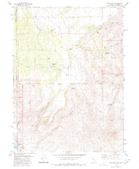
1980 Map of Mixie Flat
USGS Topo · Published 1980About this map
Mixie Flat sits at the heart of this high-desert landscape along the border of Nevada and California, as mapped by the Geological Survey in 1980. This area in Washoe County is defined by an intricate network of seasonal drainages and vital water sources, including the East Fork Smoke Creek and Parsnip Wash. The topography is characterized by dramatic elevations like Twin Peaks, with the land carved by Wilcox Canyon and Chimney Canyon.
Find a feature on this map
25 named features on this map. Tap any name to fly to it.
Don’t see what you’re looking for? This feature index may not catch every label — zoom into the map to look around manually.
Map Details
Editions of this 1980 Mixie Flat Map
2 editions found
Other maps of this area

1886 · Honey Lake
USGS Topo · 1:250,000

1886 · Granite Range
USGS Topo · 1:250,000

1891 · Honey Lake
USGS Topo · 1:250,000

1893 · Honey Lake
USGS Topo · 1:250,000

1894 · Granite Range
USGS Topo · 1:250,000

1954 · Observation Peak
USGS Topo · 1:62,500

1954 · Shinn Mountain
USGS Topo · 1:62,500

1955 · Westwood
USGS Topo · 1:250,000

1955 · Lovelock
USGS Topo · 1:250,000

1958 · Westwood
USGS Topo · 1:250,000