
1952 Map of Moab 4 NW
USGS Topo · Published 1952About this map
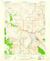
Arches National Monument defines the eastern edge of this mid-century survey, where the desert plateau breaks into the deep drainages of Moab Canyon and Seven Mile Canyon. This preliminary edition captures the essential water sources that sustained early ranching and travel through the Grand County backcountry, including Dalton Well, Lower Courthouse Spring, and Upper Courthouse Spring. The landscape is organized around grazing and resource extraction, with the expansive Courthouse Pasture and Arth Pasture contrasting with specialized sites like Cedar Ridge Well and scattered indications of mineral exploration marked simply as Mine or Prospect. The map documents the intricate network of washes, such as Bartlett Wash and Seven Mile Wash, which dictated movement through the high desert before the establishment of modern infrastructure.
Find a feature on this map
21 named features on this map. Tap any name to fly to it.
Don’t see what you’re looking for? This feature index may not catch every label — zoom into the map to look around manually.
Map Details
Editions of this 1952 Moab 4 NW Map
This is the sole edition of this map. No revisions or reprints were ever made.
Other maps of this area

1885 · La Sal
USGS Topo · 1:250,000

1951 · The Knoll
USGS Topo · 1:62,500

1952 · Moab 3 NE
USGS Topo · 1:24,000

1952 · Moab 3 SE
USGS Topo · 1:24,000

1952 · Moab 4 SW
USGS Topo · 1:24,000

1956 · Moab
USGS Topo · 1:250,000

1958 · Crescent Junction
USGS Topo · 1:62,500

1958 · Thompson
USGS Topo · 1:62,500

1959 · Moab
USGS Topo · 1:250,000
1959 · Moab
USGS Topo · 1:62,500