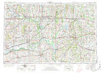
1954 Map of Moberly
USGS Topo · Published 1973About this map
The Missouri River meanders through the heart of north-central Missouri, anchoring a landscape defined by its river-and-rail economy in the mid-1950s. Major rail lines like the Atchison Topeka and Santa Fe and the Norfolk and Western converge at key hubs such as Moberly and Chillicothe, facilitating the movement of coal from local strip mines and agricultural products from the fertile plains. To the west, the river corridor includes historic river towns like Lexington and Glasgow, where the terrain begins its transition into the upland regions of the state.
Find a feature on this map
73 named features on this map. Tap any name to fly to it.
Don’t see what you’re looking for? This feature index may not catch every label — zoom into the map to look around manually.
Map Details
Editions of this 1954 Moberly Map
3 editions found

Other maps of this area

1885 · Warrensburg
USGS Topo · 1:125,000

1886 · Jefferson City
USGS Topo · 1:125,000

1887 · Harrisonville
USGS Topo · 1:125,000

1887 · Sedalia
USGS Topo · 1:125,000

1887 · Warrensburg
USGS Topo · 1:125,000

1888 · Boonville
USGS Topo · 1:125,000

1889 · Lexington
USGS Topo · 1:125,000

1890 · Mexico
USGS Topo · 1:125,000

1890 · Moberly
USGS Topo · 1:125,000

1890 · Glasgow
USGS Topo · 1:125,000