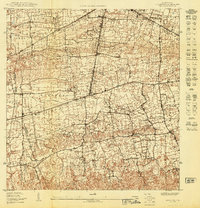
1950 Map of Moca NE
USGS Topo · Published 1950About this map
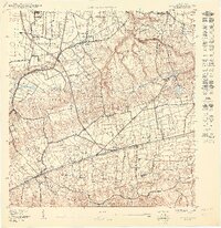
The American R R of Porto Rico cuts through the northern corner of this landscape, reflecting the coastal connectivity of the mid-twentieth century. To the south, a dense network of homesteads and small structures populates the barrios of Bejucos, Guerrero, and Arenales Bajos, illustrating the intensive land use and agricultural settlement patterns characteristic of northwestern Puerto Rico during this era. The presence of the Planta Electrica de Isabela and the prominent Canal de Desviacion suggests a developing rural infrastructure focused on water management and electrification.
Find a feature on this map
22 named features on this map. Tap any name to fly to it.
Don’t see what you’re looking for? This feature index may not catch every label — zoom into the map to look around manually.
Map Details
Editions of this 1950 Moca NE Map
This is the sole edition of this map. No revisions or reprints were ever made.
Other maps of this area

1937 · Moca
USGS Topo · 1:20,000

1938 · Quebradillas
USGS Topo · 1:20,000

1941 · Moca
USGS Topo · 1:30,000

1941 · Isabela
USGS Topo · 1:30,000

1942 · Moca
USGS Topo · 1:30,000
1950 · Moca SE
USGS Topo · 1:10,000
1950 · Quebradillas NO
USGS Topo · 1:10,000
1950 · Moca SO
USGS Topo · 1:10,000
1950 · Moca NO
USGS Topo · 1:10,000
1950 · Isabela SO
USGS Topo · 1:10,000
Featured Places
- Reparto Méndez, Isabela
- Reparto San Antonio, Isabela
- Reparto Los Remedios, Isabela
- Sector Carlos Juarbe, Isabela
- Reparto Durán, Isabela