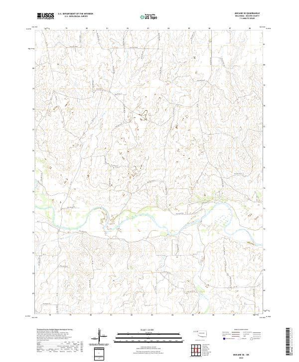
2022 Map of Mocane SE
USGS Topo · Published 2022About this map
Beaver River meanders across this landscape in Beaver County, defining the drainage patterns of the Oklahoma Panhandle. This area is characterized by a complex system of local drainage routes, including Spring Cr to the north and both Camp Cr and Duck Pond Cr to the south. The terrain is defined by a grid of rural sections and local roads, many of which follow the natural contours of the land, as seen with Hollow N1480 and Hollow N1520.
Find a feature on this map
51 named features on this map. Tap any name to fly to it.
Don’t see what you’re looking for? This feature index may not catch every label — zoom into the map to look around manually.
Map Details
Editions of this 2022 Mocane SE Map
This is the sole edition of this map. No revisions or reprints were ever made.
Other maps of this area

1954 · Perryton
USGS Topo · 1:250,000

1958 · Perryton
USGS Topo · 1:250,000

1970 · Knowles
USGS Topo · 1:24,000

1970 · Gate NW
USGS Topo · 1:24,000

1970 · Mocane NW
USGS Topo · 1:24,000

1970 · Mocane SE
USGS Topo · 1:24,000
1970 · Mocane
USGS Topo · 1:24,000

1971 · Clear Lake NW
USGS Topo · 1:24,000

1971 · Clear Lake
USGS Topo · 1:24,000

1971 · Logan NW
USGS Topo · 1:24,000