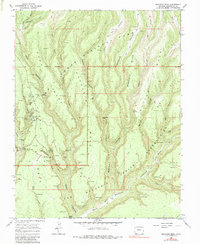
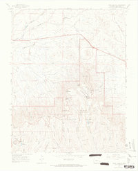
1967 Map of Moccasin Mesa
USGS Topo · Published 1983About this map
Mesa Verde National Park reveals a complex landscape of archaeological sites and steep canyon topography in this mid-century survey. The map documents numerous named ancestral dwellings and ceremonial structures, such as the Cliff Palace, Sun Temple, and Spruce Tree House, concentrated along the fingers of Chapin Mesa. The survey also marks the Old Ute Indian Reservation Boundary where the park lands meet the Ute Mountain Indian Reservation to the south and west. This boundary line bisects the deep drainage of Soda Canyon and the high ground of Moccasin Mesa. Researchers can trace an intricate network of narrow canyons, including Moccasin Canyon and Morfield Canyon, which drain toward the Mancos River. The map highlights the intersection of early tourism and conservation, showing the Park Headquarters, a Lookout Tower, and various pack trails and jeep trails providing access to remote Indian ruins and cliff dwellings like Balcony House and Square Tower House.
Find a feature on this map
67 named features on this map. Tap any name to fly to it.
Don’t see what you’re looking for? This feature index may not catch every label — zoom into the map to look around manually.
Map Details
Editions of this 1967 Moccasin Mesa Map
3 editions found
Other maps of this area

1912 · Soda Canyon
USGS Topo · 1:62,500

1915 · Soda Canyon
USGS Topo · 1:62,500

1956 · Cortez
USGS Topo · 1:250,000

1958 · Cortez
USGS Topo · 1:250,000

1959 · Cortez
USGS Topo · 1:250,000

1962 · Cortez
USGS Topo · 1:250,000

1965 · Cortez
USGS Topo · 1:24,000
1965 · Mancos
USGS Topo · 1:24,000
1965 · Point Lookout
USGS Topo · 1:24,000

1966 · Cortez
USGS Topo · 1:250,000