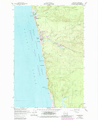
1955 Map of Moclips
USGS Topo · Published 1985About this map
The Quinault Indian Reservation boundary meets the Pacific coast just north of Moclips, marking a rugged coastal landscape defined by shifting timber and transit interests. In the mid-1950s, the inland settlement of Aloha centers on its Sawmill, connected to the coast and the northern terminal at Moclips by the Burlington Northern railroad line. This rail corridor follows the valley of Beaver Creek, providing the primary industrial link between the forest and the shore. Along the coastline, a string of seaside communities like Pacific Beach and Iron Springs are interspersed with conservation areas including the Copalis National Wildlife Refuge and the Pacific Beach State Park. The geography is shaped by the parallel drainage of the Moclips River, Joe Creek, and Elk Creek, which cut through the bluffs to the ocean, influencing the placement of local landmarks like the Moclips Aloha School.
Find a feature on this map
28 named features on this map. Tap any name to fly to it.
Don’t see what you’re looking for? This feature index may not catch every label — zoom into the map to look around manually.
Map Details
Editions of this 1955 Moclips Map
4 editions found
Other maps of this area

1938 · Moclips
USGS Topo · 1:62,500

1941 · Moclips
USGS Topo · 1:62,500

1943 · Copalis Beach
USGS Topo · 1:250,000

1951 · Copalis Beach
USGS Topo · 1:250,000

1955 · Taholah
USGS Topo · 1:62,500

1955 · Macafee Hill
USGS Topo · 1:62,500

1955 · Carlisle
USGS Topo · 1:24,000

1955 · Copalis Beach
USGS Topo · 1:24,000
1955 · Moclips
USGS Topo · 1:24,000

1956 · Copalis Crossing
USGS Topo · 1:24,000