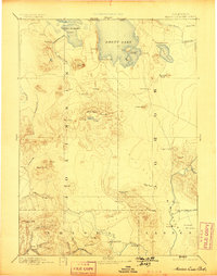
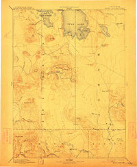
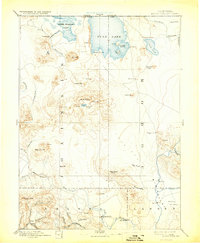
1892 Map of Modoc Lava Bed
USGS Topo · Published 1899About this map
The Modoc Lava Bed dominates this reconnaissance of the high volcanic plateau where Siskiyou, Modoc, Shasta, and Lassen counties meet. Fieldwork from the 1880s reveals a landscape defined by volcanic landmarks such as Cinder Cone, Glass Mt, and the Ice Cave. The volcanic character of the terrain dictated early settlement patterns, with isolated outposts like Bieber, Lookout, and Pittville clustered along the southern watercourses, while the north is marked by large basins like Rhett Lake and Little Klamath Lake.
Find a feature on this map
68 named features on this map. Tap any name to fly to it.
Don’t see what you’re looking for? This feature index may not catch every label — zoom into the map to look around manually.
Map Details
Editions of this 1892 Modoc Lava Bed Map
7 editions found
Other maps of this area

1886 · Alturas
USGS Topo · 1:250,000

1886 · Honey Lake
USGS Topo · 1:250,000

1886 · Lassen Peak
USGS Topo · 1:250,000

1886 · Modoc Lava Bed
USGS Topo · 1:250,000

1886 · Shasta
USGS Topo · 1:250,000

1889 · Klamath
USGS Topo · 1:250,000

1890 · Red Bluff
USGS Topo · 1:250,000

1891 · Honey Lake
USGS Topo · 1:250,000

1891 · Ashland
USGS Topo · 1:250,000

1892 · Modoc Lava-Bed
USGS Topo · 1:250,000