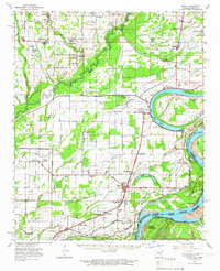
1963 Map of Modoc
USGS Topo · Published 1966About this map
The Mississippi River and its shifting historical channels dominate this 1963 study of Phillips County. The landscape is defined by the massive oxbow of Old Town Lake and the nearby Modoc Crevasse, illustrating the power of the river's floods over the delta. Highlighting the region's educational and religious history, the map identifies the Rosenwald Sch near Oneida, alongside numerous country congregations like New Jerusalem Ch and Morning Star Ch.
Find a feature on this map
78 named features on this map. Tap any name to fly to it.
Don’t see what you’re looking for? This feature index may not catch every label — zoom into the map to look around manually.
Map Details
Editions of this 1963 Modoc Map
This is the sole edition of this map. No revisions or reprints were ever made.
Other maps of this area

1930 · Mellwood
USGS Topo · 1:62,500

1935 · Clarksdale
USGS Topo · 1:62,500

1939 · Farrell
USGS Topo · 1:62,500

1939 · Modoc
USGS Topo · 1:62,500

1939 · Indian Bay
USGS Topo · 1:62,500

1939 · Henrico
USGS Topo · 1:62,500

1939 · Clarksdale
USGS Topo · 1:62,500

1939 · Latour
USGS Topo · 1:62,500

1939 · Mellwood
USGS Topo · 1:62,500

1940 · Marvell
USGS Topo · 1:62,500