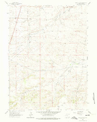
1962 Map of Moffett Ranch
USGS Topo · Published 1974About this map
Snow Ranch and Moffett Ranch anchor this early 1960s landscape in Laramie County, Wyoming, illustrating the sparse settlement patterns of the high plains. The topography is defined by the branching waterways of the Bear Creek system, including North Bear Creek, South Fork Bear Creek, and Little Bear Creek. These drainage patterns shaped the placement of local infrastructure, such as Chalk Hill Road which skirts the base of Chalk Hill. Evidence of modern utility expansion appears via a prominent Pipeline and a Pumping Station in the eastern sector. The presence of Roadside Park and several Springs highlights the essential relationship between water sources and travel through this arid terrain. This 1962 survey provides a clear view of the ranching boundaries and natural landmarks that characterized the region before further late-century development.
Find a feature on this map
12 named features on this map. Tap any name to fly to it.
Don’t see what you’re looking for? This feature index may not catch every label — zoom into the map to look around manually.
Map Details
Editions of this 1962 Moffett Ranch Map
3 editions found
Other maps of this area

1911 · Cheyenne
USGS Topo · 1:125,000

1914 · Cheyenne
USGS Topo · 1:125,000

1954 · Cheyenne
USGS Topo · 1:250,000

1958 · Cheyenne
USGS Topo · 1:250,000

1962 · Moffett Ranch
USGS Topo · 1:24,000

1962 · Lewis Ranch
USGS Topo · 1:24,000

1962 · Bristol Ridge
USGS Topo · 1:24,000
1962 · Nimmo Ranch
USGS Topo · 1:24,000

1962 · Bristol Ridge NE
USGS Topo · 1:24,000
1962 · Whitcomb Hill
USGS Topo · 1:24,000