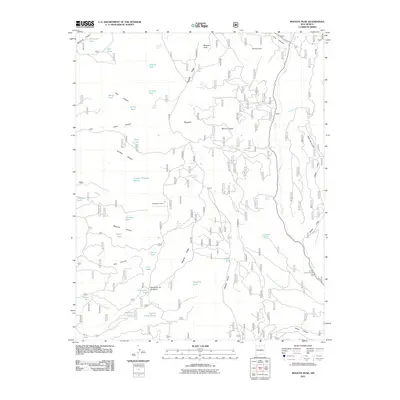
2011 Map of Mogote Peak
USGS Topo · Published 2011About this map
Mogote Peak rises above a high-elevation landscape defined by deep drainages and numerous livestock tanks in this 2011 survey of Rio Arriba County. The terrain is characterized by large mesa-like features such as Banco Lona and Banco Aragon, separated by significant canyons like Montoya Canyon and Caño Canyon. This era of land use is marked by a complex network of forest roads and water management points, including Laguna Pinabete Mocho and the curiously named Puertecito de las Ranas. Human activity is concentrated around seasonal outposts like Harris Bear Camp and recreational areas like the El Rito Picnic Grounds along the eastern edge. The map captures a transition where the high ridges of Mogote Ridge drop into the deep watercourses of Cañon Largo and Madera Cañon, illustrating the vital importance of springs such as East Sisneras Spring and Cholejo Spring in this arid environment.
Find a feature on this map
54 named features on this map. Tap any name to fly to it.
Don’t see what you’re looking for? This feature index may not catch every label — zoom into the map to look around manually.
Map Details
Editions of this 2011 Mogote Peak Map
This is the sole edition of this map. No revisions or reprints were ever made.
Other maps of this area

1918 · Abiquiu
USGS Topo · 1:125,000

1918 · Tusas
USGS Topo · 1:125,000

1953 · Valle Grande Peak
USGS Topo · 1:24,000

1953 · Magote Peak
USGS Topo · 1:24,000

1953 · Canjilon
USGS Topo · 1:24,000

1953 · El Rito
USGS Topo · 1:24,000

1953 · Canjilon SE
USGS Topo · 1:24,000

1953 · Ghost Ranch
USGS Topo · 1:24,000

1954 · Aztec
USGS Topo · 1:250,000

1955 · Cebolla
USGS Topo · 1:62,500