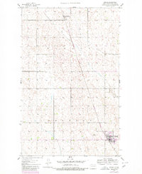
1948 Map of Mohall
USGS Topo · Published 1980About this map
Mohall serves as the primary hub of this Renville County landscape, situated at the junction of the Burlington Northern railroad and local thoroughfares. The terrain is defined by the subtle drainage of West Cut Bank Creek, which meanders across the townships of Brandon and Hurley. The 1980 edition, based on earlier surveys and updated with 1977 aerial photography, captures the agricultural character of the region during a period of transition for rural infrastructure.
Find a feature on this map
8 named features on this map. Tap any name to fly to it.
Don’t see what you’re looking for? This feature index may not catch every label — zoom into the map to look around manually.
Map Details
Editions of this 1948 Mohall Map
2 editions found
Other maps of this area

1948 · Dokken SW
USGS Topo · 1:24,000

1948 · Mohall
USGS Topo · 1:24,000

1948 · Lansford
USGS Topo · 1:62,500

1949 · Lansford NW
USGS Topo · 1:24,000

1949 · Mohall SW
USGS Topo · 1:24,000

1949 · Mohall NE
USGS Topo · 1:24,000

1949 · Sherwood
USGS Topo · 1:24,000

1949 · Greene
USGS Topo · 1:24,000

1949 · Grano NE
USGS Topo · 1:24,000

1950 · Lansford
USGS Topo · 1:62,500