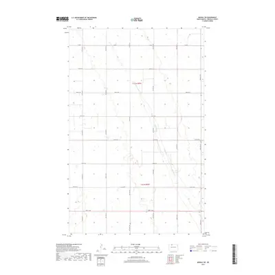
2017 Map of Mohall SW
USGS Topo · Published 2017About this map
Little Deep Cr carves a winding path through the heart of Renville County, defining the drainage patterns of this high plains agricultural landscape. The township divisions of t162n r85w and t161n r85w reveal a rigid sectional grid system, where section lines are almost universally accompanied by graded section-line roads. This network, including Co Rd 4 and various numbered routes like 99th St NW and 47th Ave NW, facilitates the transport of grain and livestock across the vast prairie. The terrain is characterized by numerous small prairie potholes and depressions, typical of the glaciated plains, which collect seasonal water between the established farmsteads and agricultural plots of this rural North Dakota interior.
Find a feature on this map
17 named features on this map. Tap any name to fly to it.
Don’t see what you’re looking for? This feature index may not catch every label — zoom into the map to look around manually.
Map Details
Editions of this 2017 Mohall SW Map
This is the sole edition of this map. No revisions or reprints were ever made.
Other maps of this area

1947 · Tolley
USGS Topo · 1:62,500

1948 · Mohall
USGS Topo · 1:24,000

1948 · Tolley
USGS Topo · 1:24,000

1949 · Mohall SW
USGS Topo · 1:24,000

1949 · Mohall NE
USGS Topo · 1:24,000

1949 · Sherwood
USGS Topo · 1:24,000

1949 · Greene
USGS Topo · 1:24,000

1949 · Grano NE
USGS Topo · 1:24,000

1949 · Mouse River Park NE
USGS Topo · 1:24,000

1949 · Mouse River Park
USGS Topo · 1:24,000