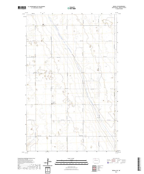
2024 Map of Mohall SW
USGS Topo · Published 2024About this map
Little Deep Creek meanders through this portion of North Dakota, cutting a northwest-to-southeast path through a landscape defined by the Public Land Survey System. The area is characterized by its organized grid of county roads and section lines, including Co RD 4 and a series of numeric streets from 93rd St NW to 99th St NW. Cultural and community history is anchored by the Saint Johns United Lutheran Cem and the Hamedly Lutheran Cem, reflecting the region’s denominational heritage and early settlement patterns. To the southeast, the Renville County Waterfowl Production Area indicates a shift toward conservation and the preservation of the prairie pothole ecosystem, providing a distinct contrast to the surrounding agricultural landscape.
Find a feature on this map
16 named features on this map. Tap any name to fly to it.
Don’t see what you’re looking for? This feature index may not catch every label — zoom into the map to look around manually.
Map Details
Editions of this 2024 Mohall SW Map
This is the sole edition of this map. No revisions or reprints were ever made.
Other maps of this area

1947 · Tolley
USGS Topo · 1:62,500

1948 · Mohall
USGS Topo · 1:24,000

1948 · Tolley
USGS Topo · 1:24,000

1949 · Mohall SW
USGS Topo · 1:24,000

1949 · Mohall NE
USGS Topo · 1:24,000

1949 · Sherwood
USGS Topo · 1:24,000

1949 · Greene
USGS Topo · 1:24,000

1949 · Grano NE
USGS Topo · 1:24,000

1949 · Mouse River Park NE
USGS Topo · 1:24,000

1949 · Mouse River Park
USGS Topo · 1:24,000