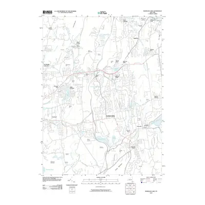
2010 Map of Mohegan Lake
USGS Topo · Published 2010About this map
Yorktown Heights and the surrounding Westchester County countryside appear here in the early 21st century, defined by a series of significant water bodies and reservoirs. The landscape is structured by major infrastructure like the Catskill Aqueduct and the Taconic State Pkwy, which cut through a terrain of named peaks including Turkey Mountain and French Hill. Residential clusters such as Shrub Oak, Jefferson Valley, and Mohegan Lake show the established suburban character of the area, while working agricultural sites like Stuart's Fruit Farm and Wilkens Fruit And Fir Farm represent the region's enduring farming tradition.
Find a feature on this map
88 named features on this map. Tap any name to fly to it.
Don’t see what you’re looking for? This feature index may not catch every label — zoom into the map to look around manually.
Map Details
Editions of this 2010 Mohegan Lake Map
This is the sole edition of this map. No revisions or reprints were ever made.
Other maps of this area

1892 · Stamford
USGS Topo · 1:62,500

1892 · West Point
USGS Topo · 1:62,500

1892 · Carmel
USGS Topo · 1:62,500

1892 · Tarrytown
USGS Topo · 1:62,500

1893 · Carmel
USGS Topo · 1:62,500

1893 · Stamford
USGS Topo · 1:62,500

1893 · Tarrytown
USGS Topo · 1:62,500

1894 · West Point
USGS Topo · 1:62,500

1894 · Carmel
USGS Topo · 1:62,500

1899 · Stamford
USGS Topo · 1:62,500