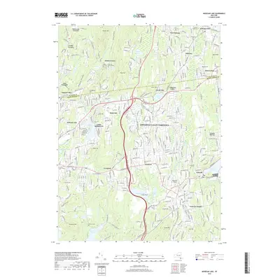
2019 Map of Mohegan Lake
USGS Topo · Published 2019About this map
The Taconic State Pkwy bisects this Northern Westchester landscape, navigating the dense network of ridges and water bodies that define the transition between Yorktown Heights and the Putnam County border. Large hydrologic features such as the Amawalk Reservoir and the New Croton Reservoir dominate the southern and eastern sectors, reflecting the region's long-standing role in the municipal water system. The terrain is notably punctuated by named summits including Granite Mtn and French Hill, which hem in residential clusters like Shrub Oak and Jefferson Valley.
Find a feature on this map
60 named features on this map. Tap any name to fly to it.
Don’t see what you’re looking for? This feature index may not catch every label — zoom into the map to look around manually.
Map Details
Editions of this 2019 Mohegan Lake Map
This is the sole edition of this map. No revisions or reprints were ever made.
Other maps of this area

1892 · Stamford
USGS Topo · 1:62,500

1892 · West Point
USGS Topo · 1:62,500

1892 · Carmel
USGS Topo · 1:62,500

1892 · Tarrytown
USGS Topo · 1:62,500

1893 · Carmel
USGS Topo · 1:62,500

1893 · Stamford
USGS Topo · 1:62,500

1893 · Tarrytown
USGS Topo · 1:62,500

1894 · West Point
USGS Topo · 1:62,500

1894 · Carmel
USGS Topo · 1:62,500

1899 · Stamford
USGS Topo · 1:62,500