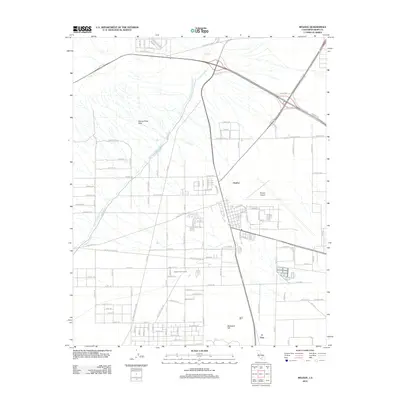
2012 Map of Mojave
USGS Topo · Published 2012About this map
The Los Angeles Aqueduct and Second Los Angeles Aqueduct cut decisively through this desert landscape, tracing a path from the north toward the populated basins below. This 2012 survey illustrates the critical infrastructure of the High Desert, where the massive Mojave Airport serves as a dominant landmark alongside the nearby settlements of Chaffee and Fleta. The map captures a transitional geography where the industrial utility of the Los Angeles DWP Easement meets recreational spaces like the Camelot Golf Course.
Find a feature on this map
68 named features on this map. Tap any name to fly to it.
Don’t see what you’re looking for? This feature index may not catch every label — zoom into the map to look around manually.
Map Details
Editions of this 2012 Mojave Map
This is the sole edition of this map. No revisions or reprints were ever made.
Other maps of this area

1915 · Elizabeth Lake
USGS Topo · 1:125,000

1915 · Mojave
USGS Topo · 1:125,000

1917 · Elizabeth Lake
USGS Topo · 1:125,000

1943 · Rosamond
USGS Topo · 1:62,500

1943 · Tehachapi
USGS Topo · 1:62,500

1943 · Mojave
USGS Topo · 1:62,500

1943 · Willow Springs
USGS Topo · 1:62,500

1947 · Plano
USGS Topo · 1:24,000

1947 · Mojave
USGS Topo · 1:24,000
1947 · Bissell
USGS Topo · 1:24,000