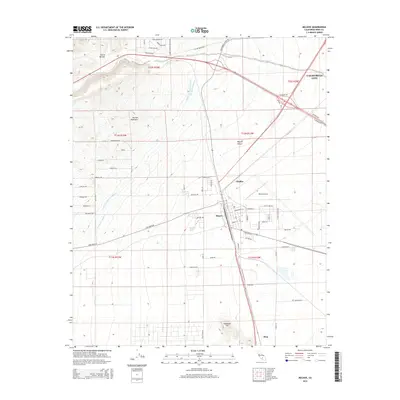
2015 Map of Mojave
USGS Topo · Published 2015About this map
Mojave serves as a critical desert junction where the foothills of the Sierra Nevada meet the western edge of the Mojave Desert. This 2015 survey details the sophisticated water and transport infrastructure essential to the region, including the Second Los Angeles Aqueduct and the expansive Mojave Airport. The map highlights a landscape defined by both natural relief and human engineering, with named elevations like Horned Toad Hills and Standard Hill rising above the grid of modern settlements. Residential and industrial expansion is visible around California City, while smaller locales like Chaffee and Fleta mark points along the primary transportation corridors. Historical layers are preserved in road names such as Pony Express Rd and Cache Creek Blvd, which trace older routes through the drainage of Cache Creek.
Find a feature on this map
53 named features on this map. Tap any name to fly to it.
Don’t see what you’re looking for? This feature index may not catch every label — zoom into the map to look around manually.
Map Details
Editions of this 2015 Mojave Map
This is the sole edition of this map. No revisions or reprints were ever made.
Other maps of this area

1915 · Elizabeth Lake
USGS Topo · 1:125,000

1915 · Mojave
USGS Topo · 1:125,000

1917 · Elizabeth Lake
USGS Topo · 1:125,000

1943 · Rosamond
USGS Topo · 1:62,500

1943 · Tehachapi
USGS Topo · 1:62,500

1943 · Mojave
USGS Topo · 1:62,500

1943 · Willow Springs
USGS Topo · 1:62,500

1947 · Plano
USGS Topo · 1:24,000

1947 · Mojave
USGS Topo · 1:24,000
1947 · Bissell
USGS Topo · 1:24,000